Know Before You Go
Places We Visit in the Canadian Rockies
Banff National Park
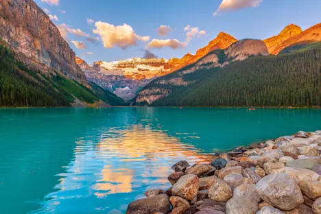
Established in 1885 as Canada’s first national park, Banff is the pride of the Canadian National Park System. Famous for its hot springs, winding river canyons, glacial lakes and ice-capped peaks, this park has something for everyone. Some of the most famous locations of the Canadian Rockies lie within Banff’s borders, such as Lake Louise, Moraine Lake, Johnston Canyon, Columbia Icefields, Icefields Parkway and Banff Hot Springs. It’s no wonder the Canadian Pacific Railway took such an interest in the area. The railway is responsible not only for providing early access to the region but also for the creation of its famous lodges. Two of the railroad’s directors named the area after their birthplace—Banffshire, Scotland. Today, over 4 million people visit annually to explore and enjoy the park’s wonders. Interestingly, the town of Banff lies wholly within the park’s borders. Though the town is incorporated as a separate entity, it does house most of the park’s administrative facilities.
Columbia Icefield and Athabasca Glacier
The Columbia Icefield spans the Continental Divide on the border between Alberta and British Columbia. It covers approximately 125 square miles of the jagged Canadian Rockies, has an average depth of 1,200 feet and spawns six major glaciers, the most famous of which is the Athabasca Glacier.
As is happening to glaciers around the world, the Athabasca Glacier is retreating at a staggering 15 feet per year. In the last 125 years it has retreated nearly a mile and has lost half of its volume. As it melts, it feeds the Athabasca River, passes through Great Slave Lake to the Mackenzie River and, ultimately, to the Arctic Ocean, 2,500 miles from where it began.
Johnston Canyon and Waterfalls
This deeply carved canyon is the result of thousands of years of the Johnston River eroding through the limestone cliffs. Over its length it drops over a series of waterfalls, spills out into wet meadows and dives out of sight into underground tunnels before it empties into the Bow River. The most popular hikes in the canyon bring you to the Upper (100 feet) and Lower (30 feet) Johnston Falls.
The original trails to these spectacular waterfalls were built by a gold prospector named Walter Camp. Banff National Park allowed him to build cabins at the mouth of the canyon that still house visitors today in order to encourage tourism in the park. The Walter family built trails and suspension bridges throughout the canyon that were…sketchy. When Walter Camp passed away in the 1970s, Parks Canada took over maintenance of the trails and built the far-safer network you can enjoy today.
Field, British Columbia
The town of Field is a 200-resident inholding that sits completely within the boundaries of Yoho National Park. It was originally a ramshackle settlement of tents and other structures built to house construction workers for the Canada Pacific Railway in the 1880s. The railway named the growing town “Field” after an American businessman, Cyrus Fields, who they were hoping would invest. That bid was unsuccessful, but another man–William Cornelius Van Horne–saw that there was wealth to be had in the physical beauty of the surrounding area. He advocated for its protection and, in 1886, the Mt. Stephen Dominion Reserve came into existence. Over time, protections expanded until the area was named Yoho National Park and its current boundaries were established in 1901.
Yoho National Park
The spirit of Yoho is captured in its name, which is a Cree expression that conveys a sense of awe and wonderment. Park highlights include Emerald and O’Hara Lakes, the Kicking Horse River and Takakkaw Falls. This waterfall plunges 1,224 feet from the cliffs above, making it one of Canada’s highest—and most impressive—waterfalls. The Cree once again chose a perfect name for this dramatic falls. Takakkaw translates simply to ‘wonderful.’
Yoho is also home to the Burgess Shale, one of the most important paleontological sites in the world. If you visited this area one billion years ago, you would have found a vast inland sea in place of the mountains you see today. Over many millions of years, sediment built up and perfectly preserved soft-tissue marine fossils from the Cambrian Period (540–485 mya). Over the past 75 million years, tectonic pressure lifted these rocks up to form the Canadian Rockies. Over time, erosion has exposed the best record of non-shelled marine organisms from the end of the Cambrian Explosion to be found anywhere on Earth.
Bugaboo Provincial Park
The Bugaboos are located to the southwest of the other parks in British Columbia, away from the continental divide. The park is famous for its spires, which provide an insanely picturesque backdrop for mountain exploits. These grand spires are home not only to world-class hiking opportunities but also to world-class rock-climbing. Visitors often have the chance to rub elbows with intrepid climbers setting off to tackle the renowned routes to the summits of Pigeon, Howser, Bugaboo and Snowpatch Spires. With our binoculars, we may be able to spot them on the walls making their ascent, offering perspective to just how high and steep these rock faces are.
Given that so many people arrive each summer to enjoy what the Bugaboos have to offer, it’s amusing to think about what the name actually means—a dead end. The first Europeans arrived here in 1885 in search of gold, but they only found fool’s gold and galena. Being surrounded by mountains and having nowhere else to go, they returned down the valley, but not before naming the mountains after the old prospector’s term for a dead end.
Join These Canadian Adventures
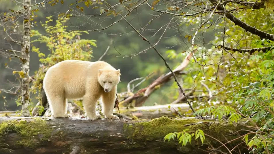
Great Bear Rainforest: In Search of Spirit Bears, Grizzlies & Whales
Discover British Columbia at its wildest, in search of the elusive white Spirit Bear in the remote valleys of western Canada's Coast Range. Offshore, scout for humpback whales and orcas in emerald fjords.

