Know Before You Go
Geography & Climate
Physical Geography
Newfoundland and Labrador is the seventh largest province of Canada, comprising an area of 156,453 square miles, including 12,100 square miles of inland water. Labrador is bounded by Québec province on the south, west and north; by the Atlantic Ocean on the east; and by the Strait of Belle Isle on the southeast. Newfoundland is bordered by the Atlantic Ocean on the east and south; by the Gulf of St. Lawrence on the west; and by the Strait of Belle Isle on the north. Newfoundland lies to the southeast of Labrador and is separated from it by the Strait of Belle Isle.
Roughly triangular in shape, the island of Newfoundland measures 350 miles from north to south and 320 miles from east to west. Labrador’s farthest extent from north to south is 620 miles, and from east to west, it is 520 miles. Almost the entire province has infertile soils with peat and rock outcroppings. The coastlines of both Newfoundland and Labrador are highly irregular, with many bays, islands and peninsulas.
Natural Regions
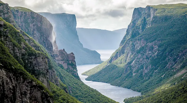
The province contains two natural regions: the Appalachian Region and the Canadian Shield. The entire island of Newfoundland, as well as a small portion of southeastern Labrador, belongs to the Appalachian Region. In Newfoundland, the Appalachian Region consists mainly of a large plateau, which can be subdivided into three smaller regions—the Newfoundland Highlands, the Atlantic Upland and the Central Lowland.
The highlands, also referred to as the “Long Range Mountains,” cover most of the western part of the island and encompass the edge of the plateau, which rises abruptly on the west and slopes gently toward the east. Elevations in this area reach a maximum height of 2,671 feet above sea level at Lewis Hills in the southwest.
The Atlantic Upland characterizes the majority of the south and east regions of the island and is primarily a flat or rolling plateau with an average elevation of about 1,000 feet. There are some rugged hilly sections located in the southeast on the Avalon Peninsula, and bogs and small lakes are very numerous throughout. The Central Lowland of Newfoundland occupies the north central part of the island. Most of this region also is flat, or gently rolling, with almost all areas situated under 500 feet above sea level.
The Canadian Shield covers all of Labrador, except for its southeastern corner. The region is generally a vast plateau made up of ancient, hard rock, with elevations ranging from 1,500 to 2,000 feet above sea level in the interior. Along the coast, the edge of the plateau is more rugged, with slightly higher elevations. The Torngat Mountains in extreme northern Labrador rise to 5,420 feet atop of Mount Cambric.
Rivers & Lakes
Both Labrador and Newfoundland encompass many rivers and lakes. The Churchill River is the province’s longest river, rising in western Labrador and flowing eastward for 208 miles before emptying into Lake Melville. Located on the river, Churchill Falls, with its vertical drop of 245 feet, is one of the greatest sources of hydroelectric power in North America. Other large rivers in Labrador are the Naskaupi, the Eagle and the Romaine.
On Newfoundland, the Exploits River is the island’s longest waterway, beginning in the southwest and flowing for 150 miles to empty into the Bay of Exploits in the north. The second longest river on the island is the Gander River, which flows in a northeasterly direction.
The largest natural lake in the province is Lake Melville in eastern Labrador—a slightly brackish lake with an area of 1,185 square miles. Lake Melville is actually an 87-mile extension of Hamilton Inlets and is connected to the ocean by a narrow passage. Smallwood Reservoir in western Labrador was created by the dams of Churchill River and is the largest body of freshwater in the province, with an area of 2,520 square miles. Grand Lake, Red Indian Lake and Gander Lake are the largest lakes on the island of Newfoundland.
Climate
A land renowned for its independence and diversity, Newfoundland is home to a fascinating array of climates and weather, many of which can be explained by the province’s geography. The island covers five and a half degrees of latitude, about the same as the Great Lakes, and its southern extremity lies close to the forty-seventh parallel, approximately the same latitude as Seattle and Paris.
There are few physical barriers to protect Newfoundland from weather systems that sweep across its lands. Its situation on the eastern side of North America favors strong seasonal contrasts in the visiting air masses. Climatically, Newfoundland is the most maritime of the Atlantic Provinces, and this is evident in all seasons, but especially in spring and summer, which are quite cool by Canadian standards. The highest daily maximum temperatures in the summer are typically 81 to 88° Fahrenheit, although the south coast is vulnerable to sea fog, so can be cooler than the northern peninsula.
Join These Canadian Adventures

Haida Gwaii: Islands at the Edge of the World
Discover an archipelago of wonder off the coast of British Columbia—explore wild shorelines, ancient rainforest and 12,000 years of Haida culture on an intimate sailboat adventure in the marine wilderness.


